Avalanche Safety

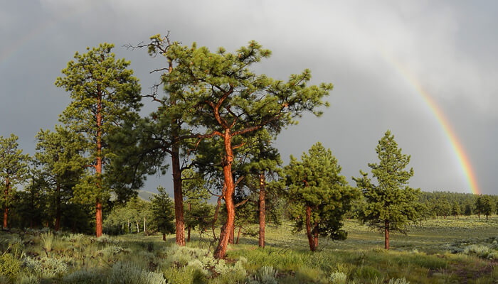
Where Do Avalanches Occur?

Above Tree Line and Below Tree Line:

Avalanches are more likely to occur above tree line where there is more exposure to the sun, wind loading, and less terrain features to hold the snow in place. However, avalanches can and do happen below tree line. Do not make the mistake of thinking just because you’re in the trees you’re safe.

Snow Load and Slope Directions:

Slopes that face the wind tend to have larger accumulations of snow drifts along with deeper, heavier snow which can lead to an avalanche. In the northern hemisphere, slopes that are facing south, south east and south west get more exposure to the sun in the winter which leads to more faceting of the snow which can create dangerous weak layers that are prone to sliding with new snow fall. North facing slopes see less sun and this can lead to deeper snow in some instances but be aware that the wind can change any snow pack on any aspect.

Know your slope angles:

The saying is “any slope can slide at any time.” The most dangerous angled slopes are around 33 to 35 degrees, but an avalanche can occur on any slope that is between 23 and 45 degrees.

When Do Avalanches Occur?

Avalanches typically occur when early or mid season snowpack forms the first few layers of snow for the year and is then exposed to the freeze-and-thaw cycle throughout the day. During the freeze and thaw cycle, the snow crystals can facet or change shape – essentially becoming little ball bearings. As new snowfall continues throughout the season, that new snow is now sitting on what is known as a weak layer that can eventually slide under its own weight or due to other natural forces or human contact.

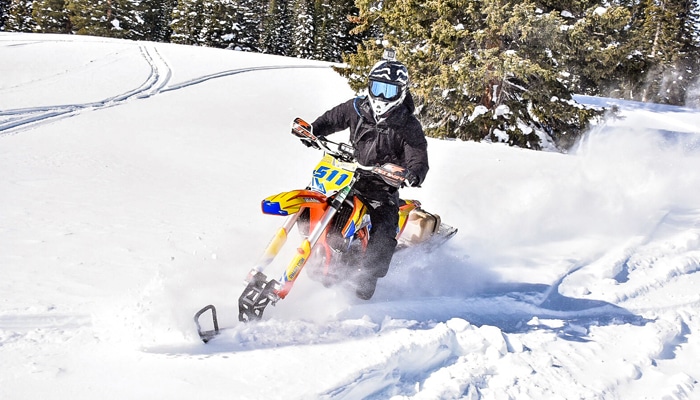
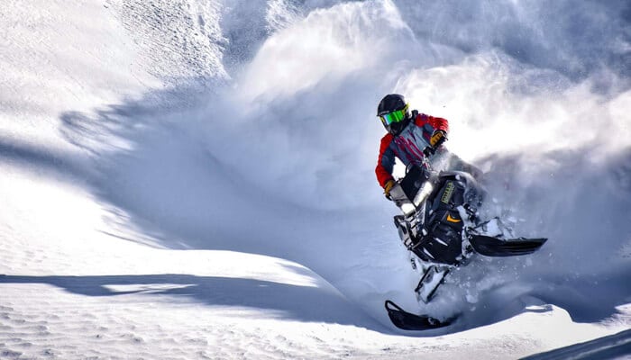
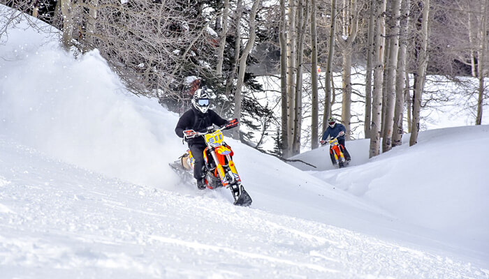
Human activities like hiking, snowshoeing, skiing, snowboarding, snowmobiling and snow biking can all stress the snowpack as we travel across the snow and can possibly trigger an avalanche. Snowmobiling and snow biking are especially dangerous because the weight of the machinery has the ability to affect deeper layers of the snowpack. When large amounts of new snow falls, the layers underneath must adjust to the new weight. This is why avalanche dangers are elevated after each new snow fall.

Avalanche Safety: How to Avoid Avalanches

Research and Planning:

When there is fresh snow, large temperature swings during the day and night, signs of other slides that have happened, whoomfing and cracking, and when CAIC says the avalanche danger is elevated, these are all signs that extra caution must be taken and travel plans must change accordingly.

Know Your Terrain:

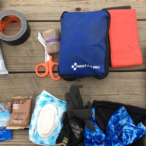
Less-steep terrain, staying below tree line, traveling on ridges, not traveling alone, carrying the bare minimum beacon shovel and probe and knowing how to use them are all things that can help mitigate avalanche danger. Staying below the tree line is usually safer but not always. Slides can and DO happen below tree line.

Take an Avalanche Safety Course:

Avalanche awareness courses are offered all over the state of Colorado and most other states that have mountains and snow. Take a course, get educated, protect yourself, friends, family and all other winter recreationists of all activities.

Traveling in Groups:

When traveling in a group, your avalanche awareness starts before arriving to the trailhead. Check to see if you can spot avalanches on your way to the trailhead? Do you hear whoomfing and cracking? Is there a known weak layer or layers of snow in the area where you plan to recreate? Have you checked the avalanche conditions and reports on the Colorado Avalanche Information Center or CAIC? Has a lot of fresh snowfall occurred in the last few days or weeks in the area?

Fresh snow fall is when most people would prefer to recreate in the mountains in the winter. This is also the time when weak layers below the new snowfall are being stressed the most and slides are more likely to happen. Spring snow in Colorado tends to be much heavier and can stress snow layers below even more.

When traversing suspect slopes it’s best practice to:

1. Send one person at a time.
2. Never ride above a cornice or steep wind loaded slope.
3. Never ride near rocks and trees that are sticking out of the snow.
4. DO NOT traverse or travel above someone.
5. When gaining altitude, stick to ridge lines where there are no obvious slide paths above your line of travel.

Use Good Judgement:

Think twice before becoming a participant in high pointing. High pointing is a competition to see who can ride to the highest and steepest point on a steep mountain side for bragging rights. A little fun like this can turn ugly very quickly. Enjoy the wild places Mother Nature has to offer, but with great respect and caution.

Ride with a Guide:

If all of this scares you- it should! Many people in Colorado are caught in avalanches each year. However, it is possible to navigate Colorado’s mountainous terrain safely in all conditions. The guides at Rocky Mountain Adventure Rentals are experts at backcountry travel and can help keep you, your family, and your friends safe while timbersledding and snowmobiling. If you are new to the sport or do not have proper training, hiring a trained guide to ride with you is the best decision you can make.

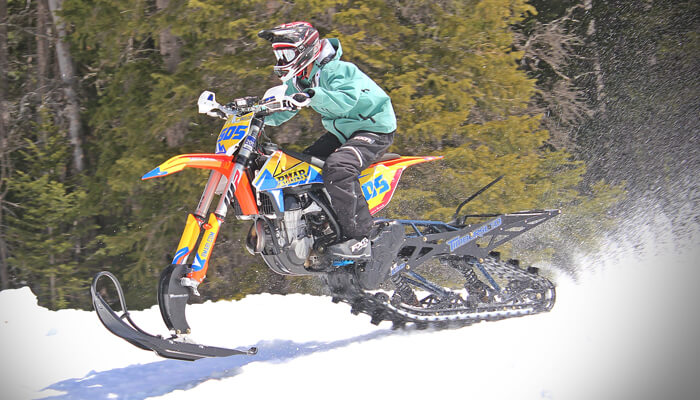
Guided Timbersled Tours: Cottonwood Pass

Experience Cottonwood Pass near Buena Vista on a Guided Timbersled Tour. Learn more about Timbersledding Cottonwood Pass

[lightframe shortname=”rmar1″ fallback=”simple” full_items=”yes” flow=”no” view_item=”202837″ class=”fh-button-flat-orange fh-shape–square fh-icon–cal”]Book Now: Cottonwood Pass[/lightframe]

Guided Timbersled Tours: St. Elmo

Explore the advanced terrain of St. Elmo near Buena Vista on a Guided Timbersled Tour. Learn more about Timbersledding St. Elmo

[lightframe shortname=”rmar1″ fallback=”simple” full_items=”yes” flow=”no” view_item=”202843″ class=”fh-button-flat-orange fh-shape–square fh-icon–cal”]Book Now: St. Elmo[/lightframe]

Backcountry Gear Checklist

Backcountry Gear: Don’t wipe with that

tips and tools for a safe backcountry experience.

It’s a beautiful day and you decide to head out to experience the great outdoors. Knowing that the weather can change at any moment, you begin to ask the question “How do I pack for the outdoors?” or “What should I bring with me?”. Having a backcountry gear checklist is essential when it comes to planning your next outdoor adventure.

To begin, start by choosing the right pack.

Before you can even begin to think about what goes into your pack, you first need to determine which pack to bring. Your pack should be durable, preferably made with waterproof or water resistant material. It should also be comfortable for you, even if you are heading out in a vehicle, you never know when you may need to walk. A 30-40 liter pack is a great size for a single day expedition.

Backcountry Gear Checklist:

There are hundreds of outdoor brands out there and even more gadgets. To help simplify the options, Let’s break down backcountry gear into 5 groups:

1. water/food storage
2. outer-wear
3. shelter
4. communication
5. first aid.

Water and food:

Being able to purify or filter water when exploring is the only way to ensure that you will have enough to stay hydrated. Make sure you practice with the pumps and filters. If you decide to use chemicals to purify water, make sure that you fully understand the correct ratios to safely use them. Many chemicals will leave an aftertaste in the water that most people find unpleasant, but they are very reliable and will not break like a mechanical filter. A water bottle that can also be used to boil water is a good way to purify water, but requires you to carry a stove or start a fire.

For day hikes, some lightweight snacks like granola bars, trail mix, chocolate and other high calorie foods are preferred. Keep in mind that animals love gray jays and marmots and squirrels are very good at finding your snacks. Don’t leave your food or pack unattended; it’s no fun to find a big hole or a chewed strap in your pack.

1. Water Filter or Filter Tablets (Chemical Tablets)
2. Water Bottle
3. Trail Snacks

Outerwear:

This is the most complicated part of trip planning and you should take the time to test out and get comfortable with this gear. Depending on the environment or time of year, you may need more or less, but a poncho or light rain gear is always recommended. gloves, a hat and sturdy hiking shoes are also recommended. For waste management, a small shovel, wet wipes and wag bags will keep you clean and happy.

1. Rain Gear
2. Gloves
3. Hats (knitted for warmth, baseball cap for sun)
4. Hiking Shoes or Boots

Shelter:

A poncho or tarp can double as a small shelter and there are many ultra light tents out there. Some bungees or 550 cord, and a sturdy knife will make creating these shelters much easier as well. Shelter also includes fire making supplies.  Flint and steel, matches, and stoves are very handy but require skill and practice to use safely. Please ensure that fires and stoves are permitted in the area you are exploring and practice the Leave No Trace principles. Patches, duct tape and a sewing kit are also great items to pack for the wear and tear that your gear will experience.

1. Tarp or Light Tent
2. Bungees or 550 cord*
3. Dependable Knife
4. Patches
5. Duct Tape
6. Sewing Kit

7. Flint and Steel
8. Matches
9. Stove


What is 550 cord?

The cord originally used on the Soldiers’ parachutes in WWII was known as “paracord”. 550 cord is simply paracord with a minimum breaking strength of 550 pounds.

Communication:

Handheld GPS, phones, InReach and other devices are great but are mechanical and can fail.  Do not rely solely on mechanical devices. Always let someone know your trip plans including the routes being used, activities you will be doing, and when you will be back. If you are using maps, ensure that everyone in you group knows where they are and that they understand how to use them. A notepad and pencil can be very helpful in emergencies as well.

1. Handheld GPS
2. Topo Maps
3. Compass
4. Notepad and Pencil

First aid: Get trained!

Basic first aid and CPR is highly recommended for anyone in the backcountry, but Wilderness First Responder classes and EMT training are even better. Check that the others in your group also have this training and have any medications they are prescribed. After you have the training, you will understand how to assemble a first aid kit and what tools you need in the specific area(s) you are vsiting. Splints, wound/bleeding management and breathing barriers are the basics but be sure to find a kit that suits your activity.

1. Splints
2. Bandaids
3. Surgical Tape
4. Surgical Glue
5. Elastic Bandages

Having a well stocked pack is essential. In time, you will find which backcountry gear works best for you. Outdoor enthusiasts love talking about gear, so don’t hesitate to ask! The more time you spend in the outdoors, the more capable you will become and you never know when a situation might arise that you will be glad you have these tools.


Colorado Trail Etiquette: ATV, UTV, RZR Side-by-Side

ATV / RZR Side by Side Trails, OHV Trails, and Dirt Bike Trails

Be courteous to all non-motorized trail users. Respect the wildlife, livestock, and all who use the trail.

All OHV and ATV trails are in danger of being closed due to the irresponsible acts of a few. As an avid user, you can help protect our available trails for motorized use by setting a good example for all and using proper Colorado Trail Etiquette while out in the backcountry. Your behavior becomes associated with all trail riders including dirt bikers, atv riders, 4×4’s, and all other forms of motorized travel. Please do not act in such a way that will leave a black eye on the sport. A little common sense and common courtesy will go a long way in helping to protect our available lands for future motorized recreation.


COLORADO TRAIL ETIQUETTE FOR MOTORIZED VEHICLES

Colorado trails for side-by-side’s, UTVs, and ATV’s

Most side-by-side’s (RZR’s) are wider than the 50″ width allowed for standard ATV Trails in Colorado. Due to the added width, all RZR’s must remain on trails that are designated for full-size 4WD vehicles. All rules and regulations are based on the actual width of your vehicle. Just because your manual suggest that your ATV is under 50″ your aftermarket wheels and tires could place the vehicle over the 50″ threshold at which point you can no longer legally use the ATV on ATV designated trails in Colorado.

Only ride on trails that are wider than your vehicle:

A general rule to keep in mind is that if your vehicle is wider than the trail, don’t proceed forward. Only dirt bikes should be on single track trails. Trail width is often associated with both the difficulty and joy of the experience. By keeping to this rule, you help preserve the tails for long-term sustainable use and help in protecting the trails integrity for all to enjoy.

When staging, do not block the trail or the access point to the trail:

Pull off to the side of the road near the trailhead to unload and prepare your vehicle for the ride ahead. Avoid driving over parking lot barriers including rocks and other objects and be mindful of your trailers and ramps.

Encountering obstacles on the trails:

Avoid going around obstacles on the trails. Doing so will inadvertently widen the trail, cause erosion issues, and negatively impact vegetation. Stay on the trail and challenge yourself to maneuver over all obstacles while being respectful to others on the trail.

In an effort to help protect the environment, these measures should be taken when encountering similar obstacles on the trail.

1. Mud Puddles:

While maintaining a steady speed, go straight through the mud puddle while being careful to not get stuck.

2. Rocks and Scree Fields:

Go over rocks and scree fields. These are natural elements on a trail and part of the challenge.

3. Downed Trees:

If the tree is too big to climb over, go back and contact the land manager or United States Forest Service.

4. Whoopdies:

Whoops are bumps on the trails that are created from continual trail use. You should proceed to go over the whoops.

5. Switchbacks:

Do not cut the switchbacks. They help with the stability of the trail.

6. Ride Single File:

On tight trails, riding single file will help to avoid braiding and help protect against the widening of the trail.

7. Crossing Streams:

If you encounter a stream that must be crossed, do so by crossing at a 90 degree angle while staying on the trail.

8. Avoid Wetlands:

Wetlands are sensitive areas of land that have been designated as protected areas and have important significance to both wildlife and humans. Avoid wetlands and other protected areas at all cost.

Slow down and let others pass:

Slower vehicles should yield to faster moving vehicles. If you are approached on the trail by a faster moving vehicle, you should pull over and allow the faster vehicle to pass. When pulling over, choose a location that is void of sensitive vegetation and be careful to not widen the trail – find a location with added width. When a vehicle approaches, signal your intent to slow down to allow the approaching vehicle to pass.

Use caution on the descent:

Unless unique circumstances exist due to location or obstacles, the descending vehicle should always yield to the ascending (climbing) vehicles.

Passing another vehicle:

When passing another vehicle (from behind), you should always pass on the left side while keeping a safe distance and speed. Signal to the vehicle you are passing and inform their party of how many vehicles remain in your group left to pass. Two fingers indicates that you have two riders behind you and one finger means that there is only one more behind you. If you are the last rider in your group left to pass, a closed fist indicates that there are no more vehicles behind you.

Different vehicles, different approach:

Know your vehicles. Not all vehicles can maneuver the same. Dirt Bikes have minimum speed requirements while it can take some time when passing full-size jeeps and trucks. Dirt Bike and RZR operators should use caution when passing – do not “roost” while passing. Roosting is the process of gassing too quickly causing stones and debris to kick back on the windshield and face visors of the vehicle and riders being passed.

Yield to non-motorized users

Always yield the trail and be prepared to stop when passing or coming across a non-motorized user. Yield the right of way to mountain bikers, hikers, trail runners, and be especially careful when approaching horses.

Be friendly and respectful:

When encountering non-motorized trail users, be courteous and understand the importance of multi-use trails. These trails help to minimize the overall impact on the environment and help to remind us that we all have the same rights to enjoy the trails.

Be aware and be helpful:

When approaching others on the trail, always slow down and provide a healthy berth to avoid surprises. If you come across others in need, pull to the side to help. As a motorized user, you often times have the ability to call for help or to seek help much faster than others.

Always respect wildlife and livestock:

Don’t chase or harass wildlife. Always leave enough space between you and the animals. If you encounter gates on your trip, be sure to leave them as you found them – if opened, leave the gate opened. If closed, leave the gate closed.

Lastly:

Stay where you belong.

1. Remember the 50″ Rule for Side-by-Sides vs ATV’s.

2. Only drive on designated, pre-existing motorized routes.

3. Always pack a map and follow the rules of the land set forth by the United States Forest Service (USFS) and the Bureau of Land Management (BLM)

Protect Your Colorado Rivers and Reservoirs

Always Clean, Drain, and Dry your boat, kayak, raft or paddle board (SUP)

Colorado is home to over 30 major rivers, 40 reservoirs, and countless lakes and streams. With the growth of invasive species being introduced throughout our bodies of water, it is important to practice sustainable behaviors when traveling between bodies of water.

Many states including Colorado are passing new laws in an effort to curb the spread of invasive species and it’s up to you to know the requirements of each body of water that you’ll be visiting. This article is intended to cover the basics to help point you in the right direction.

What are invasive species?

Invasive species are microbes, plants, and animals that find their way to areas that are not considered their natural habitat. Once established in a new location, invasive species can threaten the biodiversity of the new location and cause significant ecological and environmental damage.

Steps to Protecting Colorado Water

1. CLEAN:

Always clean your boat/SUP and gear using the water you just floated in. Remove sand, mud, and vegetation.

2. DRAIN:

Remove the standing water that is left in your boat/SUP and gear by draining it out. Use a towel or sponge to remove any water that is left in creases or tight corners.

3. DRY:

Leave your boat/SUP in the sun to let it dry out thoroughly. The chances of spreading invasive species is much lower if all of your gear is dry to the touch.

ALWAYS:

Stop at each inspection station as required by law. The size of your watercraft whether it is a kayak, paddle board, raft, or boat does not matter. The inspection is mandatory. If you have followed the above three steps, the inspection should be quick and painless.

SUP Board Rentals

Paddle Board Rentals

Call: 970-471-8491

Paddle Board Rentals from Rocky Mountain Adventure Rentals. Pick up from our Eagle-Vail location. Many sizes to choose from.

Colorado River Flows

Visit our Colorado River Map to check in on up-to-the-minute river flows. All data is collected from the United States Forest Service and is updated every 15 minutes. 

LNT Principles: Leave No Trace

Stay the trail. Don't bring glass. Pack it out.

Leave No Trace

The LNT Principles are a relatively simple set of rules to follow while in the backcountry whether you are on BLM land, National Forest, or even somewhere outside of the United States. If all outdoor enthusiasts would follow these simple guidelines, many of the once-open lands would still be open – instead of our current situation where lands are continually being closed off. At Rocky Mountain Adventure Rentals, we take pride in allowing visitors the opportunity to access areas that they would not otherwise be able to access without our equipment. Not everyone is capable of hiking deep into the woods – whether it has to do with physical fitness, age, disabilities or other obstacles. Having the opportunity to jump in a side-by-side RZR with the family and ride to the top of a mountain is more often than not a gift. If everyone, motorized and non-motorized adventurers would simply follow the rules of Leave No Trace, we will all be able to help protect our lands for future use.

Below you will find the 7 basic concepts of LNT Principles – Leave No Trace. We recommend that you take the time to set these to memory and follow the principles the next time you find yourself in the wilderness.

#1. Always be Prepared and Plan Ahead.

  • Research and educate yourself on the regulations of the area you plan to visit.
  • Be prepared for all conditions including: weather, hazards and emergencies.
  • Schedule your trip around times of high use – try to avoid over population of one area.
  • Travel in small groups.
  • Repackage food and supplies to minimize waste.
  • Use a map and compass. Avoid having to use marking paint, rock cairns or flagging.
  • Always let others know where and when you plan to be visiting a location.

#2. Travel and Camp on Designated and Durable Surfaces.

  • Designated and Durable surfaces include marked trails, campsites, rock, gravel, dry grasses, and snow. UTV, ATV’s, Dirt Bikes – You must STAY on trails. NEVER drive off of the marked trail/path.
  • Always camp at least 200 feet from lakes, rivers and streams.
  • Concentrate on using existing trails and campsites – avoid places where new impacts are beginning.
  • Always walk single file in the middle of the trail – no matter the conditions.
  • Keep campsites small.

#3. Dispose of Waste – Properly.

  • Pack it in, pack it out. Thoroughly inspect your campsite and rest areas for trash and other items including spilled foods. Pack out all of your trash, leftover food and litter. This is the most common of all broken rules.
  • Deposit solid human waste in foxholes. Your foxhole should be 6 to 8 inches deep and at least 200 feet from water, campsites and trails. Cover the foxhole when finished.
  • Always pack out toilet paper and all hygiene products.
  • To wash yourself or your dishes, carry water 200 feet away from rivers, streams and lakes. Use biodegradable soap in small amounts.

#4. Leave it Alone.

  • Preserve the past: look and inspect, but do not touch cultural or historic structures and artifacts.
  • Don’t pick the flowers. Leave rocks, plants and other natural objects alone.
  • Avoid introducing or transporting non-native species.
  • Do not build structures or dig trenches.

#5. Minimize Campfire Impacts.

  • When and where fires are permitted, use already established fire rings.
  • Keep fires small. Only use sticks from the ground that can be broken by hand.
  • Burn all wood and coals to ash and put out campfires completely. Do not leave a campfire that is still smoldering.
  • Use a small camp stove for cooking to avoid added need for a fire.

#6. Respect Wildlife- Leave the wildlife alone.

  • Do not follow approach the wildlife and only view the wildlife from a distance.
  • Do not feed the wildlife. 
  • Control your own pets at all times.
  • Avoid wildlife during times of mating, nesting, and other sensitive times.

#7. Be considerate of others.

  • Be courteous. Yield to uphill traffic on the trail.
  • When encountering horses and other pack stock, step to the downhill side of the trail.
  • Camp away from trails and other trekkers.
  • Speak softly to avoid creating loud noises.

Vail Colorado Weather

Your local forecaster is wrong... about Colorado weather

Vail Colorado weather snow conditions

Years ago I was delivering some product to a client in Vail Village. It was two days before the opening weekend which for Vail Mountain is always around Thanksgiving. The ski patrol had already posted the runs that would be available for opening day. Per usual, it was just the front side of the mountain that was set to open. Meanwhile, a few feet next to me there was a young man in his early teens standing next to his younger brother. While looking at the large trail map that was mounted on the wall, the younger of the two was pointing out all of the runs he was hoping to ski. In a fit of rage, the older brother threw his arms in the air, tossed out a few choice words and finished by saying “None of those runs are open. They are never open. Every year we come here, they are never open.”

Now you can understand the young mans’ frustration. He most likely traveled a long way with the hopes of skiing the back bowls of Vail in untracked powder. To make matters worse, when the young man looks up on the mountain, he can clearly see that all of the peaks are covered in snow. However, when he reviews the map, he learns that those same runs that are covered in snow will not actually be opening.

You can’t blame the kid for his frustration. You also can’t blame Vail Resorts. Vail Resorts has a responsibility to their guests to provide a safe environment and when it comes to early season snowfall, many times, it takes a while for the snow to settle and form a safe base to ski on. That is a battle that Vail Resorts and all winter-based companies here in the mountains deal with. Even here at Rocky Mountain Adventure Rentals, we need to perform early season snow depth checks to make sure the regions are ready to ride. It is the reality of the early season.

Early season snow conditions only represent one of the many challenges that local mountain businesses have to navigate in order to have a successful winter season.

One of the larger challenges is dealing with the professional guessers of the world who call themselves “Weather Forecasters” or “meteorologist.” They are much like Punxsutawney Phil but without the pizzazz and fanfare. Now I’m probably being a little too harsh and maybe a bit childish in my name calling but I felt it was the best way to vent my frustrations with the industry as a whole.

There is a national lack of understanding when it comes to the Colorado Rocky Mountains and the weather patterns of the state of Colorado as a whole. I myself, who is originally from the Detroit area, used to believe that Denver was a cold city and that Denver represented the majority of Colorado. After all, Denver is the most widely known city in the state and the state itself is known for alpine skiing. I moved to the central mountains back in ’98 and have since learned that the direct opposite is true when it comes to weather and temperature. Denver is a very warm, high desert climate and the weather of Denver very rarely represents the Colorado Rocky Mountains. Often times, when Denver is experiencing a warm period in the middle of winter, it is still very much in fact, a winter wonderland here in the mountains. To that point, Denver is currently seeing temperatures in the mid 70’s and yet here in the high country, our snowpack is at 118-124%. Unfortunately, the local weather forecasters around the country feel it necessary to shout to the world that “Colorado” is seeing unseasonably warm temperatures which creates an uphill battle for all of us local businesses that depend on the winter travelers.

When the forecasters of the world lump the entire state of Colorado in with Denver’s weather pattern, you can literally see online searchers and bookings drop severely. Vail Resorts is often times the most susceptible to this penalty but even the local, small businesses feel the pain. What makes the matter even more difficult is that at a micro level, even the mountain towns see warm weather during the winter months that do not reflect the snow on the hill. Here in the Vail Valley, many locals choose to live in Edwards, Colorado because of the “Banana Belt” as it’s called. The belt is a strange occurrence where the western canyon causes a split in the weather pattern. Edwards will stay sunny and warm while the mountains to the north and south stay covered in snow. Even as I write this article, I am sitting in shorts and a T-shirt while watching my neighbors heading out to go cross-country skiing.

To even further complicate the forecast, the mountains can create their own weather pattern and their own precipitation – known as the Orographic Lifting. Orographic lifting refers to the changes in air flow when the topography of the land forces the air up a mountain. When the weather system moves across the land, it has no choice but to follow the topography of the land below it; air must go over mountains and through the valleys. As elevation changes with terrain, the pressure and temperature of the weather system change as well. All of this combined can cause the Mountains to create their own weather system and precipitation.

We recently had a family call us from South Carolina concerned about their travel plans. After hearing their local weathermen speak of the unseasonably warm temperatures in “Colorado” they began to question their own vacation plans. Thankfully, they had the foresight to call us and confirm whether or not the reports were true. We were able to quickly explain what the snow conditions were versus the in-town temperatures.  They made the trip out and at the end of their stay, they thanked us because they had the time of their life being able to ski and snowmobile in great snow conditions while enjoying the warmer temperatures in town.

Small businesses can’t afford to mislead people here in the mountains; we are too dependent on loyal customers. If you do plan on coming to Colorado to enjoy the snow, please do not put your travel plans in the hands of a weather forecaster in Toledo. Simply call the local shop that you plan on visiting or at the very least visit the Rocky Mountain Adventure Rentals Snow Report which displays the base depths of all of the Colorado snow basins. You can also visit sites such as snotel which are more scientific in their approach and unlike local weathermen, snotel is not trying to create a story out of nothing.

You worked hard for your vacation, don’t let it pass you by because of an irresponsible forecaster who didn’t take the time to research the difference between Denver and the state of Colorado. Many forecasters’ around the country fail to even recognize that the snowiest months in Colorado are actually in March and April.

I write this piece on behalf of all local mountain businesses here in the great state of Colorado. It’s a topic that has been bothering me for years and I felt now was the time to put those thoughts to paper due to the increase in faulty reports nationwide.

Whitewater Rapid Classifications

It’s almost impossible to predict what to expect on a river. It’s a living, moving, and ever changing body of water. To help you prepare for a day on the river, there have been certain rapid classifications set-up to help you better understand what to expect for specific sections of river. Though not an exact science, Whitewater Rapid Classifications are set between Class I and Class VI. We have assembled this list to help you understand how River Rapids are Classed and Characterized. Always keep in mind that the rapid classes are often times left for debate as to whether or not a particular rapid is actually a class ll or say a class lll – it is often times up to the paddler(s) to decide what the class is based on their own level of skill. For this reason, the Whitewater Rapid Classifications are really more of a guide and they are used to represent how difficult the rapid is to navigate – not how much fun the rapid is.

Class I Rapids

Class I Rapids include fast moving water with ripples and small waves. Their are few obstructions, which are for the most part obvious and can be easily avoided with basic training and knowledge. The risk to swimmers is marginal and self-rescue is fairly easy.

Class II Rapids

The class II rapids are usually wide and clear with channels that are evident without scouting. Maneuvering maybe required but to a trained paddler, rocks and waves should be easily missed. Rapids that are borderline in this class are often referred to as “Class II+” and swimmers are rarely injured and group assistance is rarely needed.

Class III Rapids

Class III Rapids are moderate with irregular waves which can be difficult to avoid and can swamp an open canoe, kayak and/or Ducky. Good boat control in tight passages or around ledges is often required and large waves or strainers may be present but should be easily avoided. Eddies and powerful current effects can be found most commonly on large-volume rivers. Inexperienced parties should always scout the river before taking on the rapids. Injuries are often rare while swimming but having group assistance might be required to avoid long swims. Class III- and Class III+ labels are often times given to rapids that are on the lower or higher side of difficulties within the “Class III” rapids.

Class IV Rapids

Both intense and powerful rapids that require precise boat handling. Depending on the river, the rapids may include large and unavoidable waves, holes, or constricted passages which require quick thinking and maneuvers under pressure. A fast, reliable eddy turn may be a needed skill to initiate maneuvers, scout rapids, or rest. Some rapids may include “required” moves above dangerous hazards. Scouting recommended for the first time down. Swimmers will experience a moderate to high risk of injury and water conditions could make self-rescue impossible. Group rescue is preferred, if not essential, and requires an experienced set of skills. Having a solid eskimo roll is highly recommended. Class IV- and Class IV+ labels are given to rapids that are on the lower or higher side of difficulties within the “Class IV” rapids.

Class V Rapids

These rapids can be extremely long, obstructed and very often times violent and leave the paddler exposed to risk. Drops most likely contain large, unavoidable waves and holes or steep chutes with complex, demanding routes. Class V rapids will continue for long distances between pools which demands experience and core fitness. Few eddies will exist and most likely will be small, turbulent, and difficult to reach. Scouting is essential and can often times be difficult. DON’T Swim, but if you do, swims will be dangerous and rescue is usually difficult even for trained and experienced experts. You must have a very strong and reliable eskimo roll, proper equipment, extensive experience and appropriate rescue skills. Their is a large range of difficulty that exists beyond Class IV and Class V is a multiple-level scale designated by class 5.0, 5.1, 5.2, and so on.  Each level is an order of magnitude more difficult than the last. Example: going from a Class IV to a Class V is the equivalent of going from a class 5.0 to a 5.1.

Class VI Rapids

These are impossible and mostly left to the crazies who have a death wish. In fact, the overwhelming majority of these rapids have never been attempted and they exemplify the extremes of river difficulty, unpredictability and danger. Errors are very severe and rescue is probably impossible. These rapids are left to teams of experts/professionals at favorable water levels. Upon proper inspection and taking all necessary precautions professional teams will run these rapids many times over and upon relative continued success, the rapids will be re-classed to the appropriate rating if changed at all.