
Vail Pass
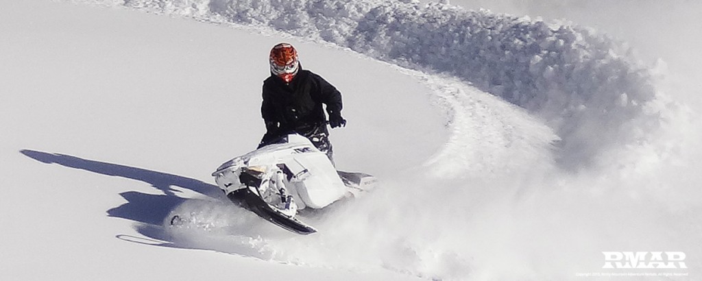
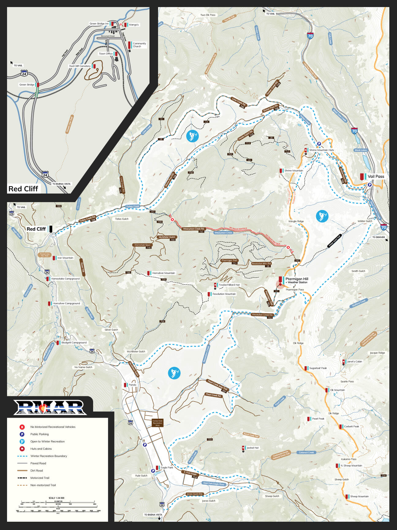
If you’re renting an RZR Side-by-Side, Snowmobile or Timbersled from us, the first place we will recommend you visit is Vail Pass. The Vail Pass Recreation Area located in the Central Rocky Mountains is a 65,000+ acre playground for back country enthusiasts. For Colorado Adventure seekers, Lime Creek Road is one the main connecting routes between the Vail Pass Recreation Area and Red Cliff, Colorado and has some of the more difficult terrain to cover on the pass. At the base of the road in Red Cliff sits the very popular Mango’s Restaurant; known for its fish taco’s and great beer selection. During the summer, parking is free to the public but due to high traffic in the winter, there is now a $10 per day parking fee which can be paid at the service booth.
Lime Creek Road is often times filled with snowmobile’s and back country skiers who are hitching rides. The road is an intermediate trail and offers just over 15 miles of packed track. Lime Creek will eventually connect with Shrine Pass Road and you even pass the Shrine Pass Cabins and if you’re up for a short hike, you can head out to the Mt. Holy Cross look out point – it offers a great deck for lunch picnics.
There are a variety of connecting trail routes that you can access via Lime Creek Road but be aware that not all trails are meant for winter travel. The U.S. Forest Service does not allow snowmobile and timbersled access to all routes. View our Colorado Map or grab a copy of the U.S. Forest Service map to learn more.
Location Details
No Permit Required
Parking Available
Over 65,000 Acres
Located in White River National Forest
Seasonal Activities
Snowmobiling / Timbersleds
Back Country Skiing / Snowboarding
Snowshoeing / XC Skiing
RZR's / 4x4 / Dirt Biking
Hiking / Backpacking
Vail Pass Map

YOU ARE RESPONSIBLE
- Alway have Avalanche rescue gear and know how to use it.
- Uphill traffic and snowcats have the right of way.
- Ride single file. Pass on the left.
- Use designated pick-up/drop-off spots.
- Stay in control.
- Always ride the fall line.
- NEVER ride above groups.
These maps are for reference only. Always carry certified U.S. Forest Maps and GPS devices while in the back country. It is your responsibility to know the hazards involved in back country travel and to use proper safety gear and procedures to minimize risks and hazards.